Route panoramique : la route de la Roche
LIEN FICHE SIT 5914121Warning: Attempt to read property "term_id" on array in /home/isere/public_html/wp-content/plugins/sit-core/src/Templates/Services/Components/BlocSITMetas.php on line 27
Warning: foreach() argument must be of type array|object, bool given in /home/isere/public_html/wp-content/plugins/sit-core/src/Templates/Services/Components/BlocSITMetas.php on line 35
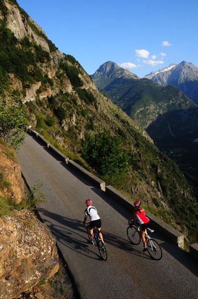
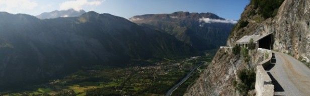
A magnificent drive on one of the most spectacular roads of Oisans and that’s saying something! An amazing technical feat lead to the Route de la Roche being opened in 1902.
The first ever road to get to Auris and its hamlets. The construction of this road was synonymous with progress and the end of isolation. Up until 1895 the only way to get to Auris was on foot or donkey by the "chimney" path.
After the village of L’Armentier-Le-Haut, the road opens up to a vast horizon!
If you’re scared of heights, turn back now!
The road is narrow. It is not advised for motorhomes.
In practice
Time schedule
From 01/01/25 to 12/31/25
-
Monday :
Open
-
Tuesday :
Open
-
Wednesday :
Open
-
Thursday :
Open
-
Friday :
Open
-
Saturday :
Open
-
Sunday :
Open
See more
-
The Auris balconies
Lieu : Le Bourg-d'Oisans
Dénivelé 1168m

-
Maronne > le pont Romain de Sarenne - Hiking
Lieu : La Garde-en-Oisans
Dénivelé 112m
-
Alpe d'Huez, the Col de Sarenne and the Auris balconies
Lieu : Le Bourg-d'Oisans
Dénivelé 1978m
-
La Ville > l'Armentier - Hiking
Lieu : La Garde-en-Oisans
Dénivelé 340m
-
Les hameaux d'Auris
Lieu : Auris-en-Oisans
Dénivelé 250m
-
Le Pont-Romain
Lieu : La Garde-en-Oisans
Dénivelé 150m


Information mise à jour le 13/09/2021
par Oisans Tourisme
null