
N°12 Entre Deux Lacs VTTAE - Bleu
LIEN FICHE SIT 6166557
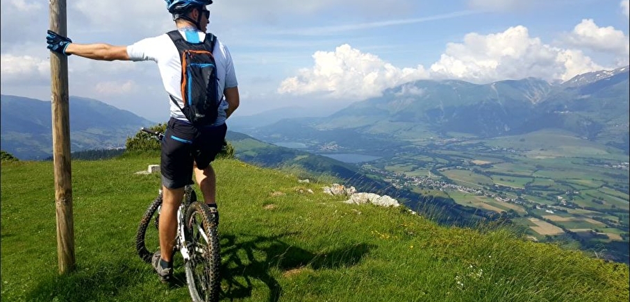
A key route to discover the lakes of the Matheysine region. Along the Creys ridge you'll enjoy beautiful views over the Matheysine plateau and beyond.
The whole family can follow this varied itinerary with moderate altitude gain.e
En pratique
- Acceptés
Publics
- Level bue - Medium,
- Mountain bikers
Animaux acceptés
- Acceptés
From the Campsite, follow the direction the Canal du Moulin and Le Sarret. From Pierre Châtel Church, head uphill towards the cemetery, and to Picardon and Ventafau, until you reach the ridge at Le Bouchet.
Follow the ridge to the Col du Crey pass, then go back downhill to Les Gonthéaumes via Touche et Bouis. Go downhill the road du col des Creys and turn left on the trail Chemin des Vagnoux to the Chapel of Petichet.
Cross the RN85 and take the first road on the right to the Messiaen lookout point, then go straight towards La Fayolle.
When you reach the intersection with the “La Fayolle” trail, continue on the road then take the first track on the right which leads to Cholonge. At Cholonge turn right towards Les Vorges, then take the uphill track off to the right towards Les Pré Dessous, then Les Troussiers. At Sous Les Troussiers, follow the signs to Pré Sabot, then Les Cordeliers.
Services
- Pets welcome
Équipements
- Public WC,
- Picnic area
Nature du terrain
- Stone,
- Ground,
- Hard coating (tar, cement, flooring),
- Grit
Informations complémentaires
Langues parlées
- French
Durée moyenne d'une visite groupée
- 1.75h
Ouvertures
All year round.
Subject to favorable weather.
Périodes
- Autumn,
- Summer,
- Winter,
- Spring
Tarifs
Free access.
A voir aussi


Go there
Latitude : 44.967729
Longitude : 5.78048
38119 Pierre-Châtel
Go there
Information mise à jour le 23/01/2025
par Matheysine Tourisme
null

