
Modified departure - Snowshoeing itinerary: Croix de Chamrousse
LIEN FICHE SIT 5154906
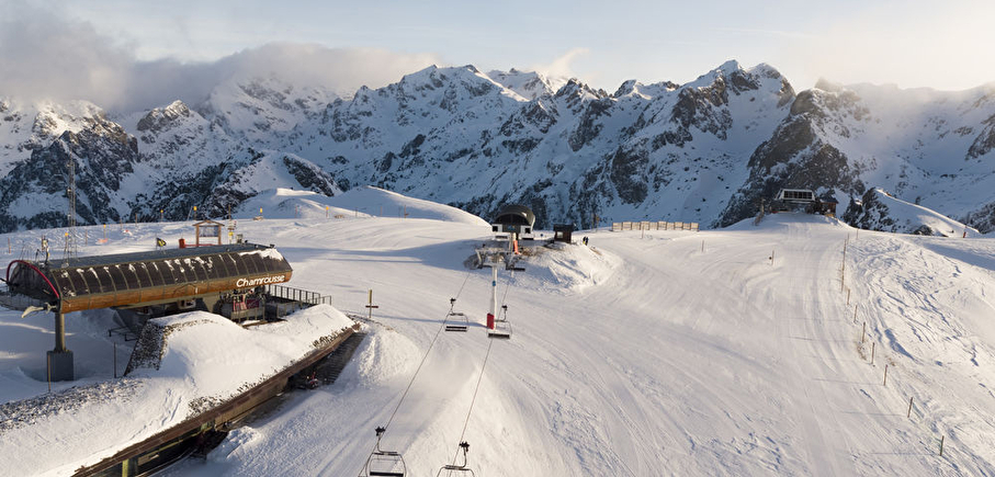
Climb to the top of the Chamrousse resort, through the forest and discover magnificent views.
Departure point: uphill bend in the Bachat Bouloud road, near the Skiset store.
From Route de Bachat Bouloud: approx. 5h round trip / 7km and 520m ascent.
On arrival, the view of Grenoble and the Grésivaudan valley is breathtaking.
Please note that dogs are not allowed on this route.
En pratique
- Non acceptés
Publics
- For experts / practiced,
- Level black - very hard
Animaux acceptés
- Non acceptés
Conditions d'accueil des animaux
- Pets forbidden on slopes (part of the traject)
Équipements
- Parking nearby
Nature du terrain
- Non-groomed itinerary
Informations complémentaires
Langues parlées
- English,
- French
Durée moyenne d'une visite groupée
- 5h
Ouvertures
From 15/12 to 15/04.
Subject to snow conditions.
Périodes
- Autumn,
- Winter,
- Spring
Tarifs
Free access.
A voir aussi
-
Chamrousse snowshoeing tracks
Lieu : Chamrousse

-
Croix of Chamrousse historic site
Lieu : Chamrousse
-
Modified departure - Snowshoe itinerary: Lac Achard via Clairières
Lieu : Chamrousse
Dénivelé 225m
-
Chamrousse Oisans viewpoint
Lieu : Chamrousse
-
Adrenaline Park - Chamrousse giant zipline
Lieu : Chamrousse


Go there
Latitude : 45.103552
Longitude : 5.882705
Height : 1700
Chamrousse 1700
38410 Chamrousse
Go there
New start: uphill bend in the Bachat-Bouloud road.
Public transport :
- Chamrousse 1700 - Villages du Bachat: station shuttle - "Épicéas - Villages du Bachat" stop (to/from Chamrousse 1750 - Roche Béranger)
- Chamrousse 1750 - Roche Béranger (+ station shuttle or walking approach approx. 15 minutes) :
- regular bus service all year round: N93 (to/from Grenoble), stop "Chamrousse 1750" [merging of former bus routes T87, Transaltitude and Destination nature Skibus / Estibus 707].
- bus line / shuttle on reservation weekdays excluding public holidays: Flexo 57 to/from Uriage [former TAD TouGo transport on demand - line G701].
Information mise à jour le 05/02/2025
par Office du Tourisme de Chamrousse
null
