
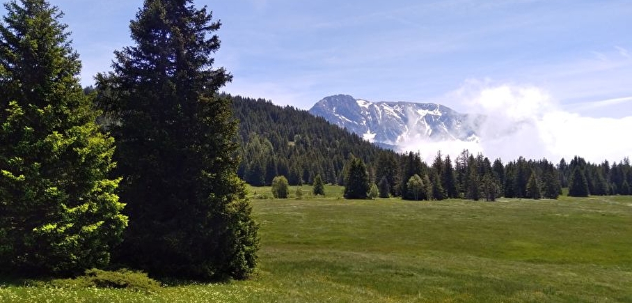
Loop of the Arselle plateau running trail
LIEN FICHE SIT 5787368
Green level running trail around Arselle plateau.
Departure: Arselle plateau in Chamrousse 1600.
Easy running trail. Estimated running time based on an average speed of 7km/h.
⚠ Warning: the Arselle plateau is a protected area (peat bog classified as an APPB - Arrêtés Préfectoraux de Protection Biotope), so there are a few rules to respect to help protect it. Fire, wild camping, bivouac, picking and dumping of waste are strictly forbidden. Please stay on the path around it, it is forbidden to go on the plateau in order to preserve the fragile environment.
En pratique
- Non disponible
Publics
- Level green – easy,
- For athletes
Animaux acceptés
- Non disponible
Informations complémentaires
Langues parlées
- French
Durée moyenne d'une visite groupée
- 0.75h
Ouvertures
From 15/06 to 30/09.
Périodes
- Autumn,
- Summer,
- Spring
Tarifs
Free access.

Go there
Latitude : 45.099553
Longitude : 5.877865
38410 Chamrousse
Go there
Station road access from Grenoble: Rocade Sud > exit no. 2 "Uriage" > Route départementale 111 (RD 111) on the Luitel side.
Park along the road + approach walk (approx. 10 minutes).
Public transport :
- regular bus service all year round: N93 (to/from Grenoble), stop "Chamrousse 1750" [merging of former bus routes T87, Transaltitude and Destination neige Skibus / nature Estibus 707].
- bus line / shuttle on reservation weekdays excluding public holidays: Flexo 57 to/from Uriage [former TAD TouGo transport on demand - line G701].
Information mise à jour le 24/04/2025
par Office du Tourisme de Chamrousse
null
