
Le Ruisseau des Pavés
LIEN FICHE SIT 136972
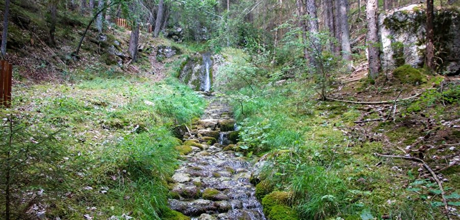
Come and discover this small stream hidden in a large forest above Cordéac. A trail with several stations will help you understand the history of this cobbled stream!
Mountain torrents have always been difficult to contain between snowmelt and heavy precipitation. This fun trail invites you to discover how mankind has managed to control the flow of water. You'll also learn how the atypical ruisseau des pavés was formed...
En pratique
- Acceptés
Publics
- For beginners / novice,
- Children,
- Walkers/hikers,
- Level bue - Medium
Animaux acceptés
- Acceptés
1) Look for the first sign "Sentier du ruisseau des Pavés". First follow the track, which climbs steeply, then a little further up, the path starts off to the right and enters the forest. The trail twists and turns through the forest along the famous "ruisseau des pavés". A series of stations explain the original history of this creek. Take advantage of the coolness of the area to take a short break and watch the water flow. Be careful with children, as the stones are slippery.
2) Continue uphill, joining a forest track. Turn right for a fine view of the surrounding peaks. The path continues downhill to the right. Beware, it can be slippery. You'll come to a magnificent forest, and continue until you reach a crossroads. At this junction, take the path that continues downhill, signposted so you don't get lost.
3) This pretty path offers views of the peaks, and you'll pass by some nice fields. You'll soon come to the yellow "Chalanne" signpost, and follow the signs for Le Châtel by taking the wide track that rises to the right. You'll soon reach your starting point.
Services
- Pets welcome
Équipements
- Free car park,
- Car park
Nature du terrain
- Ground,
- Grit
Informations complémentaires
Tourisme adapté
- Not accessible in a wheelchair
Durée moyenne d'une visite groupée
- 2h
Ouvertures
Deprecated: nl2br(): Passing null to parameter #1 ($string) of type string is deprecated in /home/isere/public_html/wp-content/plugins/timber-library/vendor/twig/twig/src/Environment.php(497) : eval()'d code on line 51
Périodes
- Autumn,
- Summer,
- Winter,
- Spring
Go there
Latitude : 44.82053
Longitude : 5.834957
Height : 978
38710 Châtel-en-Trièves
Go there
Information mise à jour le 12/02/2025
par Office de Tourisme du Trièves
null


