
Itinéraire raquettes - Balcon de Roche Rousse
LIEN FICHE SIT 707876
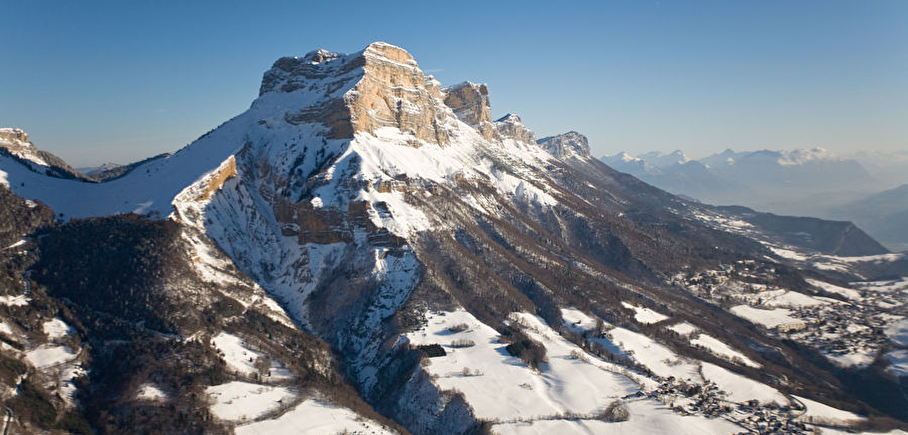
Loop from the village of Sappey under the cliff of Chamechaude (the highest point of the Chartreuse), the cliff of Roche Rousse.
Departure from "La Croix du Rocher", above the parking lot of the cross-country ski center. Climb the way that passes between the two houses and follow it. At the end, pass an opening in the fence and climb through the meadow following the markings. Once on the main track, go up again by the road opposite to the junction at the place called Monjalat. Continue up to Montjalat at the top.
Follow on the left by the way that goes into the forest. Enjoy a passage in a clearing to admire the cliffs of Roche Rousse. At the next junction, turn left to pass over the hameau de Churut. Continue to return to Monjalat.
Then go down the road following the GR and go down to the Charmette next to the starting point.
En pratique
- Acceptés
Publics
- Level bue - Medium
Animaux acceptés
- Acceptés
Services
- Pets welcome
Informations complémentaires
Langues parlées
- French
Durée moyenne d'une visite groupée
- 2.5h
Ouvertures
From 01/12 to 31/03.
Subject to favorable weather.
Périodes
- Autumn,
- Winter,
- Spring
Tarifs
Free access.
Go there
Latitude : 45.258213
Longitude : 5.779355
38700 Le Sappey-en-Chartreuse
Go there
Bus N62, départ "Notre Dame Musée" à Grenoble - Arrêt "Sappey place"
Information mise à jour le 10/03/2025
par Chartreuse Tourisme
null
