
guidance pathway Adult
LIEN FICHE SIT 5962853Warning: Attempt to read property "term_id" on array in /home/isere/public_html/wp-content/plugins/sit-core/src/Templates/Services/Components/BlocSITMetas.php on line 27
Warning: foreach() argument must be of type array|object, bool given in /home/isere/public_html/wp-content/plugins/sit-core/src/Templates/Services/Components/BlocSITMetas.php on line 35
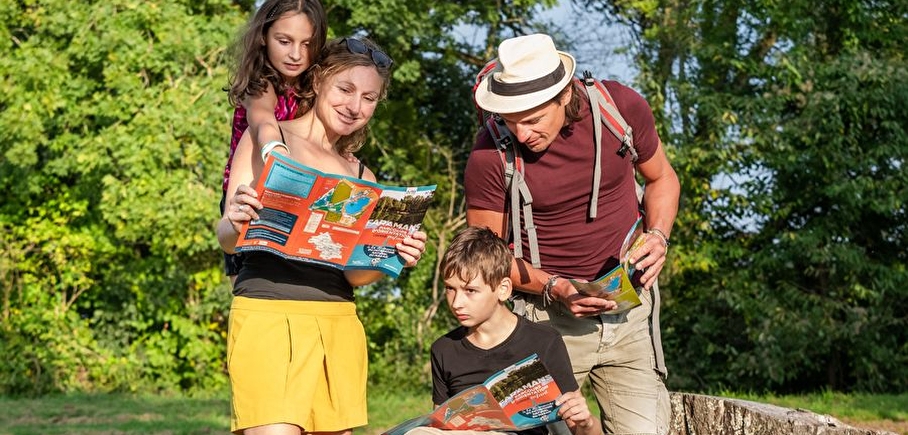
With you map, you will walk across a part of the Arselle's plateau to discover tags in Chamrousse 1700 around Bachat-Bouloud villages.
You will be on the Belledonne mountains, at the Chamrousse resort, at 1600m high. In forests or clearings, you wil discover different bogs, which are natural and fragile areas. This place welcome specific flora and fauna in this biodiversity inside the forest. It is a protected area Natura 2000 and is part of the local sensitive natural areas.
Leaflets are available for free during opening hours in :
• Chamrousse Tourist Offices in Chamrousse 1650 - Recoin (all year) and Chamrousse 1750 - Roche-Béranger (only during summer and winter high season)
• Chamrousse Environment and Heritage Centre in Chamrousse 1650 - Recoin (only open during high season)
• Town Hall in Chamrousse 1750 - Roche-Béranger (all year)
In practice
Equipments
- Parking nearby
Services
- Pets welcome
Time schedule
From 06/15/25 to 11/15/25
-
Monday :
Open
-
Tuesday :
Open
-
Wednesday :
Open
-
Thursday :
Open
-
Friday :
Open
-
Saturday :
Open
-
Sunday :
Open
Prices
Free access.
See more
-
Orienteering course for children
Lieu : Chamrousse

-
The Arselle plateau
Lieu : Chamrousse
-
Pedestrian path "Plateau de l'Arselle": access from lower parking [L1]
Lieu : Chamrousse
-
Pedestrian path "Arselle plateau": access from upper parking [L2]
Lieu : Chamrousse
-
Guide service office
Lieu : Chamrousse
-
Loop around the Arselle plateau
Lieu : Chamrousse
Dénivelé 100m
-
Chamrousse 1600 - Arselle plateau webcam
Lieu : Chamrousse


Go there
Latitude : 45.103504
Longitude : 5.882599
Height : 1700
38410 Chamrousse
Go there
Station road access from Grenoble: Rocade Sud > exit no. 2 "Uriage" > Route départementale 111 (RD 111) on the Luitel side.
Public transport :
- Chamrousse 1750 - Roche Béranger (+ walking approach approx. 15 minutes) :
• regular bus service all year round: N93 (to/from Grenoble), stop "Chamrousse 1750" [merging of former bus routes T87, Transaltitude and Destination nature Skibus / Estibus 707].
• bus line / shuttle on reservation weekdays excluding public holidays: Flexo 57 to/from Uriage [former TAD TouGo transport on demand - line G701].
Information mise à jour le 15/04/2025
par Office du Tourisme de Chamrousse
null

