
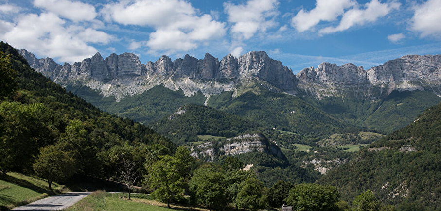
From one bank of the Gresse to the other - Cycling path n°6
LIEN FICHE SIT 5022168
Covering the roads of the northern Trièves region, this
loop takes you on either side of the Gresse river.
the Gresse river. Your calves are in for a real treat with the ascent of the Col de l'Arzelier from the Saillants du Gua!
En pratique
- Non acceptés
Publics
- Cyclists,
- Level red – hard
Animaux acceptés
- Non acceptés
Équipements
- Parking nearby
Nature du terrain
- Hard coating (tar, cement, flooring)
Informations complémentaires
Durée moyenne d'une visite groupée
- 165h
Ouvertures
All year round.
Subject to favorable weather.
Périodes
- Autumn,
- Summer,
- Winter,
- Spring
Tarifs
Free access.
Tips
You'll find everything you need for minor repairs at every Tourist Office branch.
A voir aussi
-
Between Trièves and Diois - Cycling path n°8
Lieu : Clelles
Dénivelé 1763m

-
Villages in the heart of the Trièves - Cycling path n°2
Lieu : Mens
Dénivelé 574m
-
The East Vercors Balcony - Cycling path n°5
Lieu : Monestier-de-Clermont
Dénivelé 854m
-
From Obiou to Mont-Aiguille - Cycling path n°7
Lieu : Clelles
Dénivelé 906m
-
From the foothills of the Vercors to those of the Dévoluy - Cycling path n°9
Lieu : Mens
Dénivelé 1882m
-
Panoramic views of the Trièves - Cycling path n°3
Lieu : Mens
Dénivelé 716m
-
From Grand-Veymont to Deux-Sœurs - Cycling path n°4
Lieu : Gresse-en-Vercors
Dénivelé 655m


Go there
Latitude : 44.915689
Longitude : 5.633833
Height : 835
38650 Monestier-de-Clermont
Go there
SNCF Line 63 GRENOBLE-VEYNES-GAP (Monestier station)
Information mise à jour le 02/01/2025
par Office de Tourisme du Trièves
