
Cycling route: Uriage - Chamrousse (Luitel road side)
LIEN FICHE SIT 4995950
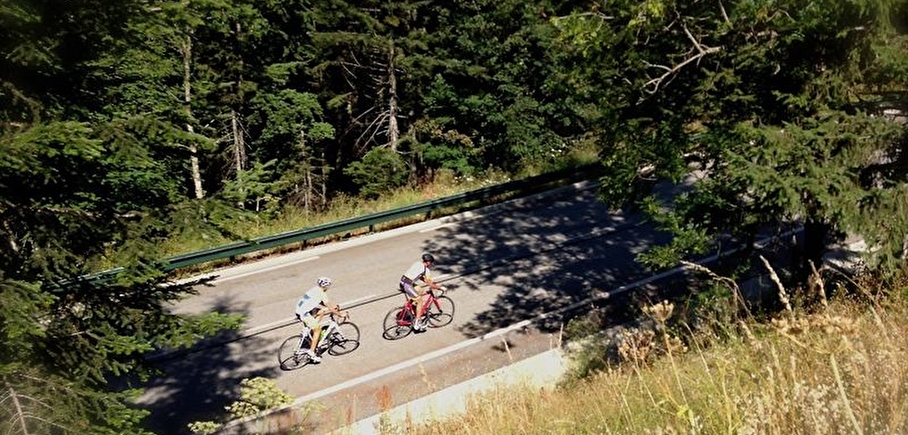
For experienced cyclists, take on the sporty Chamrousse climb!
- Start: Uriage golf traffic circle (411 m)
- Finish: Col de Chamrousse (1795 meters) at Chamrousse 1750 -Roche Béranger.
A fairly sporty route on departmental road no. 111, with many curves and twists and turns on a wide carriageway.
It crosses the fir forest before reaching the resort, offering spectacular views over the Grenoble valley and surrounding mountains.
En pratique
- Non disponible
Publics
- For experts / practiced,
- Level black - very hard,
- For athletes
Animaux acceptés
- Non disponible
Équipements
- Ping pong table,
- Public WC
Nature du terrain
- Hard coating (tar, cement, flooring)
Informations complémentaires
Langues parlées
- English,
- French
Langues documentation
- English,
- French
Ouvertures
All year round.
Subject to favorable weather.
Périodes
- Autumn,
- Summer,
- Winter,
- Spring
Tarifs
Free access.
A voir aussi
-
Timed ascent cycle race
Lieu : Chamrousse
Évènement terminé -
Col de Chamrousse - mountain pass
Lieu : Vaulnaveys-le-Haut
Dénivelé 1382m

-
Road-cycling route: Chamrousse ascent from Uriage
Lieu : Saint-Martin-d'Uriage
Dénivelé 1401m
-
Road bike itinerary: Uriage - Chamrousse (uphill on Seiglières side)
Lieu : Chamrousse


Go there
Latitude : 45.113915
Longitude : 5.878742
Height : 1795
Chamrousse 1750
38410 Chamrousse
Go there
Information mise à jour le 15/04/2025
par Office du Tourisme de Chamrousse
null
