Oursière waterfall
LIEN FICHE SIT 214493Warning: Attempt to read property "term_id" on array in /home/isere/public_html/wp-content/plugins/sit-core/src/Templates/Services/Components/BlocSITMetas.php on line 27
Warning: foreach() argument must be of type array|object, bool given in /home/isere/public_html/wp-content/plugins/sit-core/src/Templates/Services/Components/BlocSITMetas.php on line 35
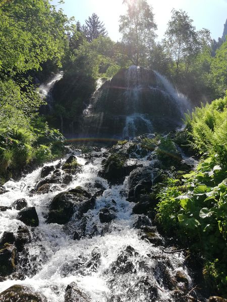
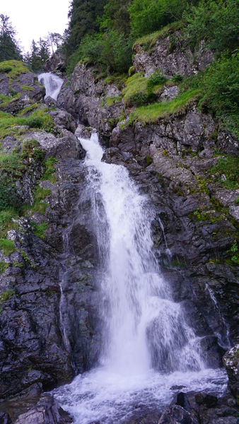
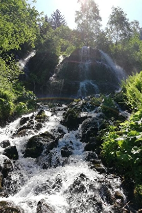
The Oursière waterfall, the natural power of water.
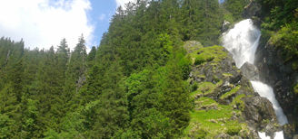
The Oursière waterfall is very impressive with its 80 metres height.
Once very popular with spa-goers in the early 19th century, the successive waterfalls make it the most refreshing spot in the area. Between shady switchbacks and vertiginous streams, this place of rejuvenation is ideal for hot weather.
The ruins of the former chalet-hotel de l'Oursière are still visible just before you reach the final 80m-high waterfall.
It can be reached on foot, by hike or trail during the summer months, from the departmental road 111 up to Chamrousse, by parking in the parking lot next to the Auberge des Seiglières (or from the locality of "la Gafe").
In practice
Sustainable tourism
Like the winter sports, which is inseparable from the image of the Alpine mountains, the theme of water is a major issue for the Belledonne and Chamrousse massif. It is distinguished both by the great variety of its sites (lakes, waterfalls, marshes), places of tourist activities, and by a diversity of atmospheres, thanks in particular to a framework preserved on the environmental and landscape level.
Time schedule
From 04/15/25 to 11/15/25
-
Monday :
Open
-
Tuesday :
Open
-
Wednesday :
Open
-
Thursday :
Open
-
Friday :
Open
-
Saturday :
Open
-
Sunday :
Open
Prices
Free access.
See more
-
La Gafe (Parking cascade) - Cascade and Oursière plateau
Lieu : Chamrousse
Dénivelé 540m

-
Croix de Chamrousse - Cascade de l'Oursière
Lieu : Chamrousse
Dénivelé 840m
-
La cascade de l'Oursière
Lieu : Saint-Martin-d'Uriage
Dénivelé 500m
-
La Gafe (Parking cascade) - Cascade and Oursière plateau
Lieu : Chamrousse
Dénivelé 540m
-
Croix de Chamrousse - Cascade de l'Oursière
Lieu : Chamrousse
Dénivelé 840m
-
Hiking without a car - The Oursière waterfall and the Robert lakes
Lieu : Chamrousse
Dénivelé 1147m


Go there
Latitude : 45.145644
Longitude : 5.915326
38410 Chamrousse
Go there
From Grenoble: car or bus + hike.
Resort road access: Rocade Sud > exit no. 2 "Uriage" > Route départementale 111 (RD 111) Seiglières side.
Recommended parking: Seiglières or La Gafe
Public transport :
- regular bus line: N93 (to/from Grenoble), "Les Seiglières" stop (merger of former T87, Transaltitude, Destination neige Skibus / nature Estibus 707)
- reserved transport on weekdays excluding public holidays: Flexo 57 (to/from Uriage), "Les Seiglières" stop (former TAD TouGo - line G701)
Information mise à jour le 11/02/2025
par Office du Tourisme de Chamrousse
null