
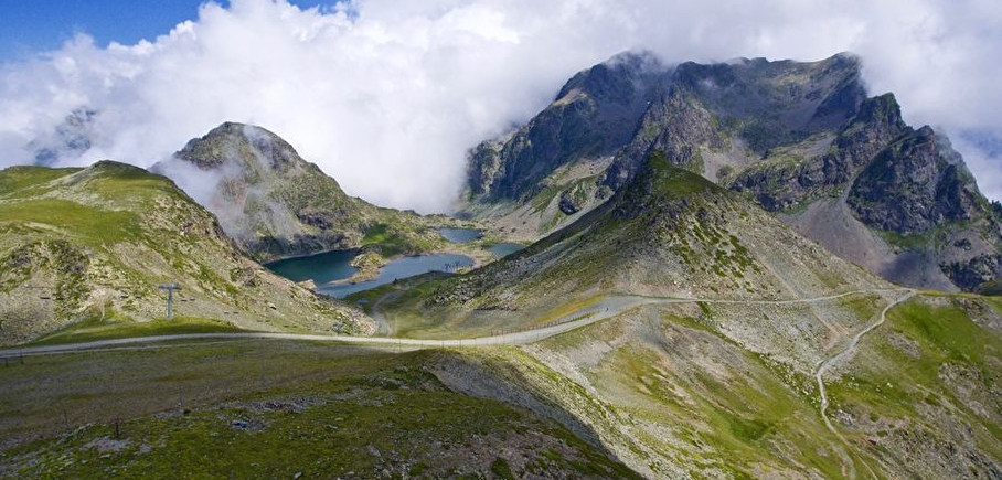
Big tour of Chamrousse running trail
LIEN FICHE SIT 5787787
Black level running trail in Chamrousse.
Departure: Tourist Office 1650 - Recoin.
Loop: Chamrousse 1650 – Vallons lake – Robert lakes – Chamrousse 1650.
Very difficult running trail.
Estimated running time for an average speed of 7km/h.
En pratique
- Non disponible
Publics
- Level black - very hard,
- For athletes
Animaux acceptés
- Non disponible
Informations complémentaires
Langues parlées
- French
Durée moyenne d'une visite groupée
- 119h
Ouvertures
From 15/06 to 30/09.
Périodes
- Autumn,
- Summer,
- Spring
Tarifs
Free access.
Go there
Latitude : 45.125603
Longitude : 5.879115
38410 Chamrousse
Go there
Station road access from Grenoble: Rocade Sud > exit no. 2 "Uriage" > Route départementale 111 (RD 111) Seiglières side.
Recommended parking: Parking Henry Duhamel (P7), avenue Henry Duhamel (200 m, approx. 2-minute walk).
Public transport - Chamrousse 1650 - Recoin stop:
- regular bus service all year round: N93 (to/from Grenoble), "Chamrousse 1650" stop (merging former T87, Transaltitude, Destination neige Skibus / nature Estibus 707)
Good to know - another stop less than 500m away (Place de Belledonne, near the Tourist Office):
- transport by reservation on weekdays excluding public holidays: Flexo 57 (to/from Uriage), "Chamrousse - Le Recoin" stop (former TAD TouGo - line G701)
Information mise à jour le 23/04/2025
par Office du Tourisme de Chamrousse
