Le Châtel
LIEN FICHE SIT 6193710
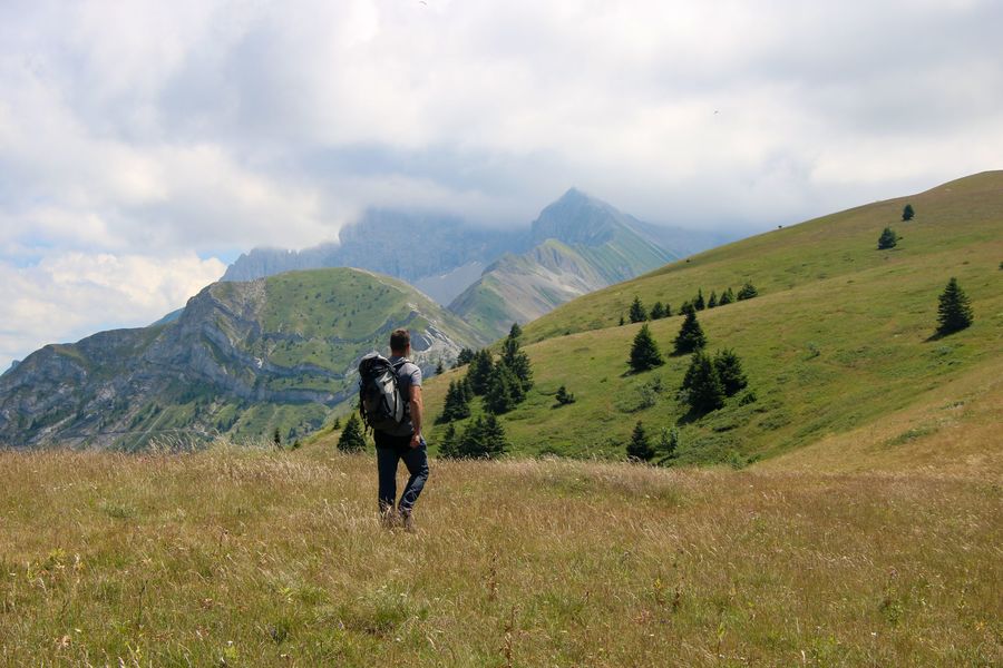
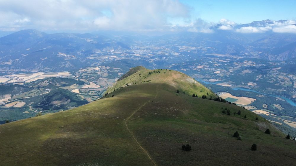
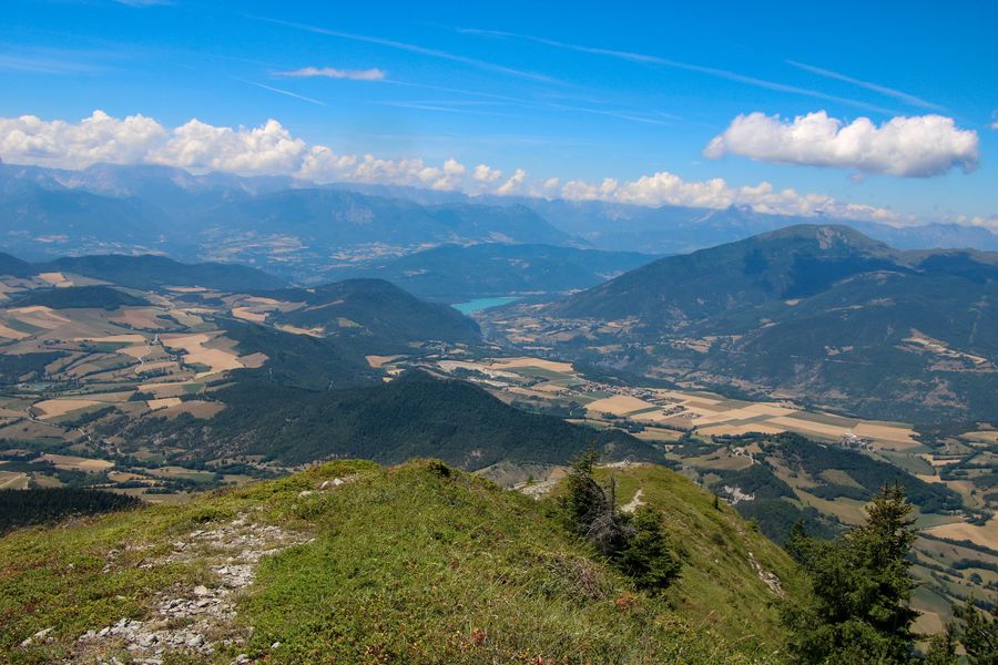
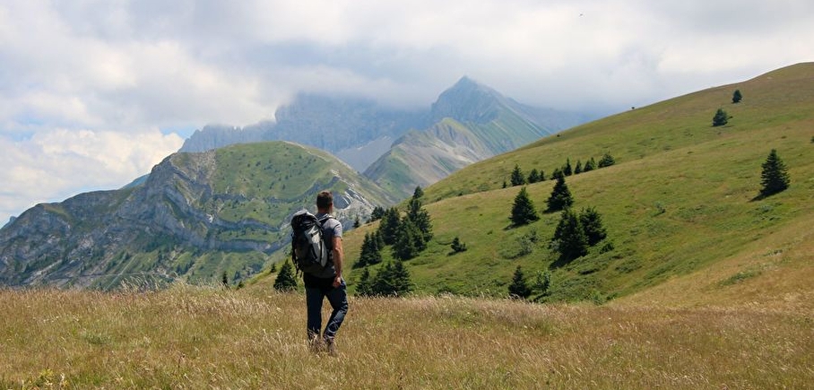
Take a magnificent trip to the top of the emblematic Châtel. One of the finest views of the colorful patchwork of Trièves farmland awaits you!
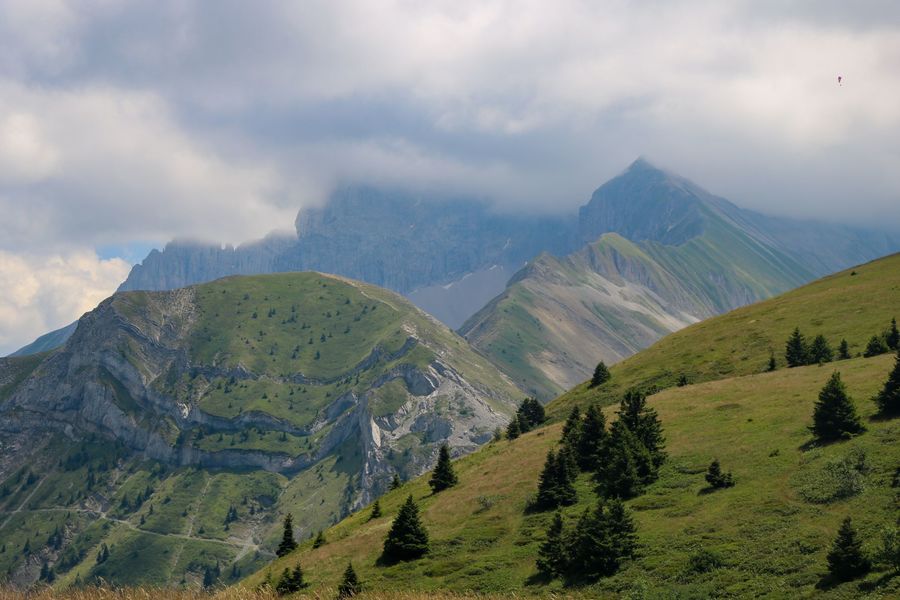
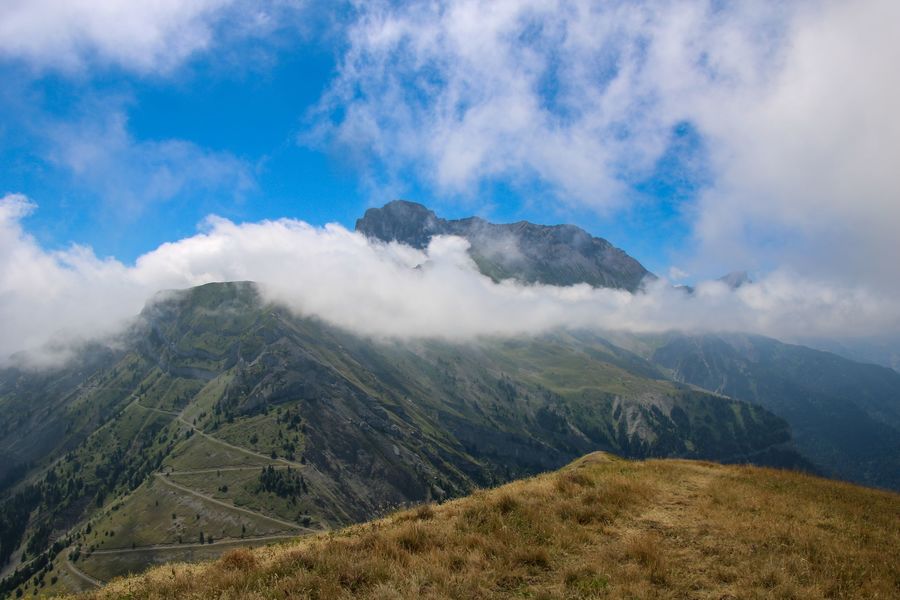
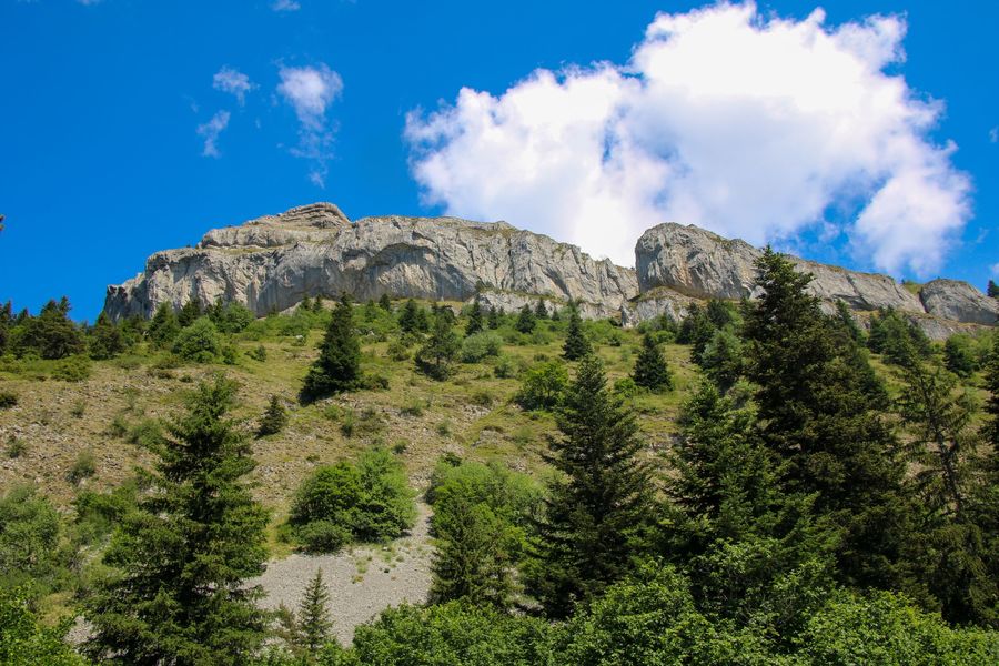
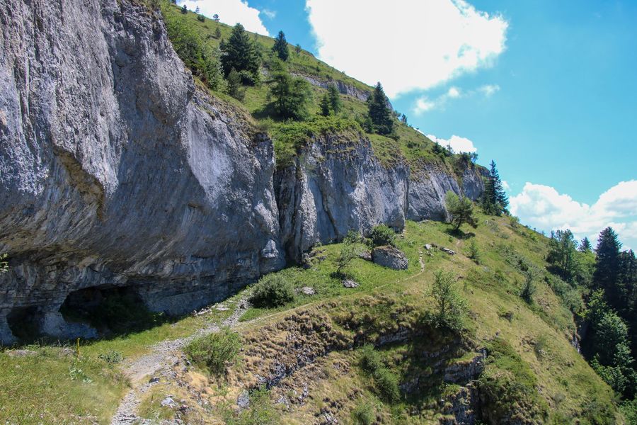
La Châtel, also known as Bonnet de Calvin, is a fairly difficult hike with some vertiginous passages. The cliffs near the summit are home to a wide variety of birds of prey. If you're lucky, you may come across vultures, eagles or falcons. This distinctive mountain can be seen from all over the Trièves. When you're at the top, you'll have a panoramic view of all the surrounding massifs. The perfect opportunity to take a day trip and have a picnic with a magnificent view. This out-and-back version avoids the cabled passage over the Col de la Brèche, which can be daunting for some hikers. Another topo allows you to do the complete loop.
En pratique
- Acceptés
Publics
- Orange level - quite hard,
- Walkers/hikers
Animaux acceptés
- Acceptés
Conditions d'accueil des animaux
- Only on a leash! Caution, presence of guard dogs. Do not bring your dog during these periods.
1) From "Baret", follow the path into the forest towards "Le Châtel". You will soon come to a signpost entitled "Les Granges de Châtel".
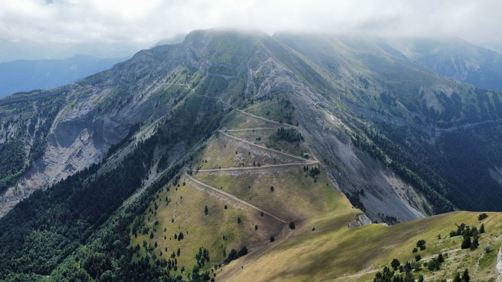
2) From "Les Granges de Châtel", follow the path up into the forest towards "Le Châtel". A pleasant climb through the forest will enable you to quickly gain altitude and begin to see the cliffs of Le Châtel.the path leads to a track which you take on the left to continue up to a clearing. After a short flat crossing, the climb becomes more difficult and the path passes beneath the cliffs. After crossing over to the right, the path rises again to finally reach the "Le Châtel" signpost.
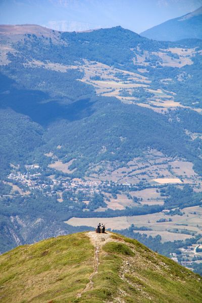
3) From "Le Châtel" you have two options. You can go left to see the panoramic view from the orientation table. Alternatively, climb a little further to the top of Le Châtel, turning right at the signpost. This path will take you to a marker indicating the summit. From here, you can enjoy views of the Dévoluy Massif and, in particular, the Obiou. It's possible to make these two round trips.
4) From the "Châtel" post, start your descent towards the "Les Granges de Châtel" post. Take the same route as you did on the way up, but be careful!
5) Once you've reached the "Granges de Châtel" post, head for the Baret parking lot to reach your starting point.
Services
- Pets welcome
Équipements
- Free car park,
- Car park,
- Sustainable development,
- Outhouse,
- Picnic area
Nature du terrain
- Ground,
- Grit,
- Not suitable for strollers
Informations complémentaires
Tourisme adapté
- Not accessible in a wheelchair
Langues parlées
- French
Durée moyenne d'une visite groupée
- 3.5h
Ouvertures
All year round.
Périodes
- Autumn,
- Summer,
- Winter,
- Spring
Tarifs
Free of charge.
A voir aussi


Go there
Latitude : 44.82229
Longitude : 5.790699
Height : 1282
38710 Mens
Go there
By car, from the Mens Tourist Office, follow signs for Cordéac, Corps.
At the "La Croix" crossroads, which indicates the gendarmerie on the right and the D 66 on the left, go straight on towards "Le Verdier".
Pass "Pré Clos", "Mentayre", then "Le Verdier" until the tarmac road becomes a track.
Follow the forest track for 3.5 km to the "Baret" parking lot.
Information mise à jour le 12/02/2025
par Office de Tourisme du Trièves
null