Arselle plateau
LIEN FICHE SIT 4972840
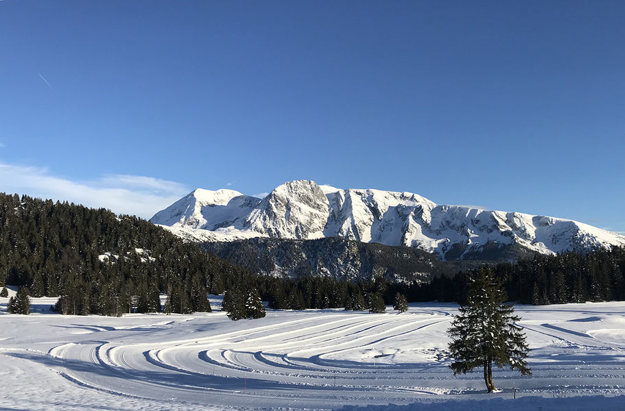
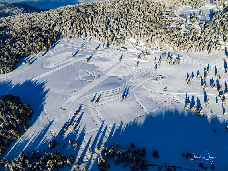
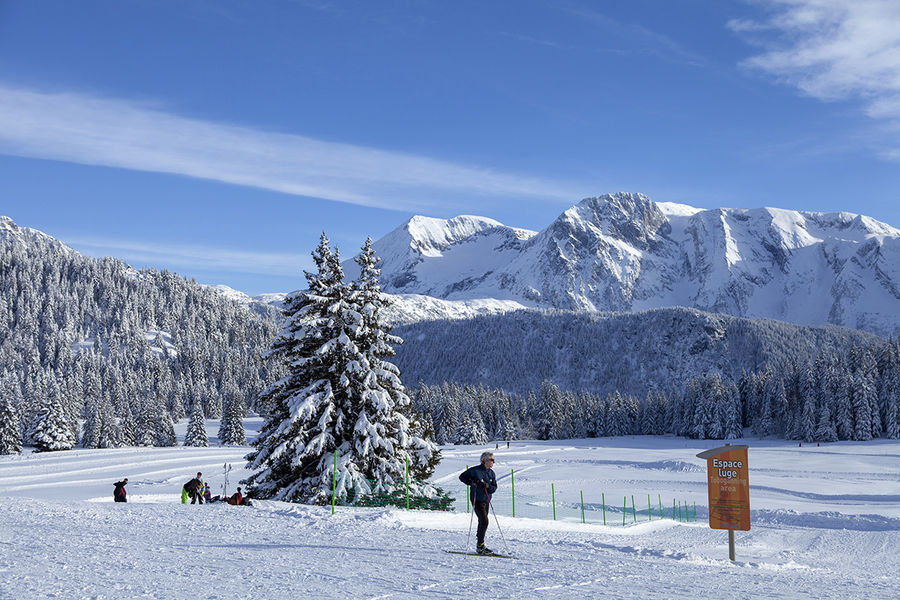
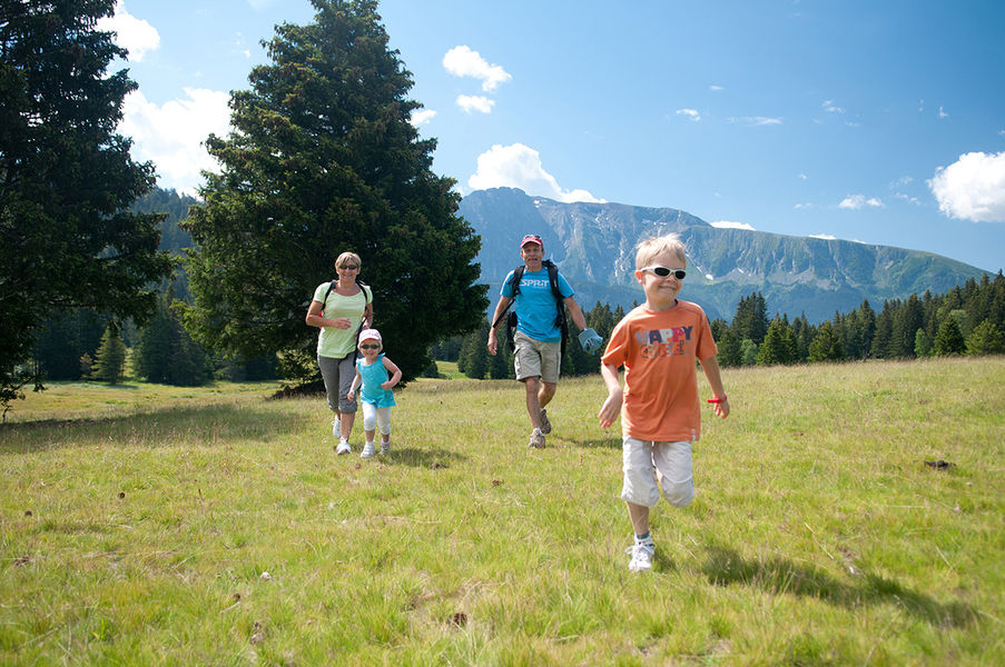
In winter or in summer, this loop path is very accessible and easy for the whole family. Explore the Arselle peatbog and its vews on the Taillefer.
From the salle hors-sac / foyer de ski de fond, take the wide trail down past the restaurant de la Salinière. Leave the track and turn left onto a narrow path that runs along the edge of the forest and alongside the peat bog.
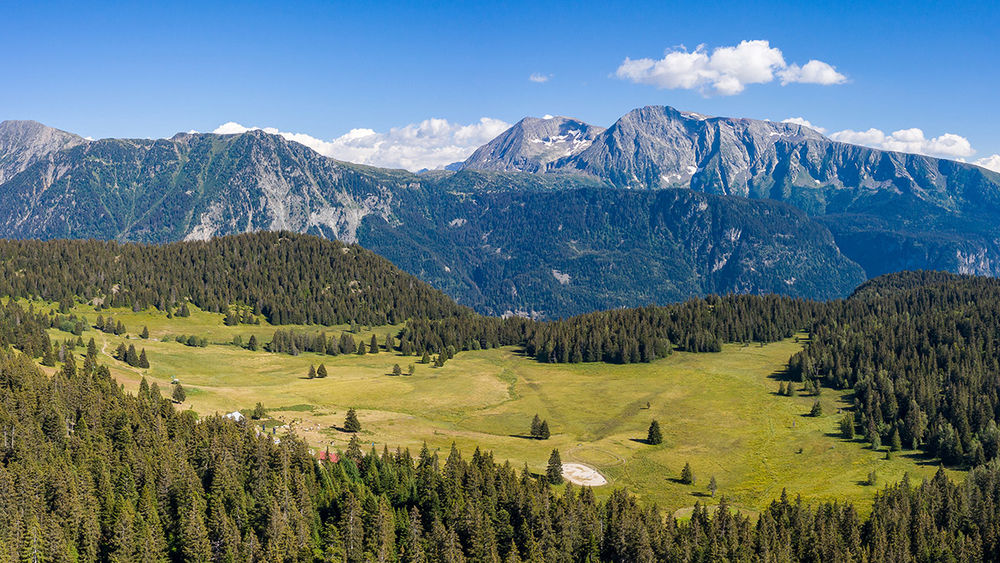
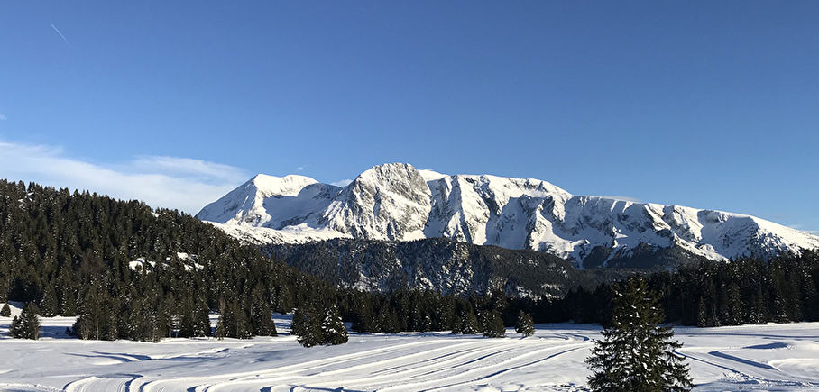
Continue south towards the Plateau de l'Arselle. An incursion into an area of meadowland offers a magnificent panorama of the neighbouring Taillefer massif.
After a short climb, a wider path leads you to the "La Lanse" signpost. Leave the path leading up to Lac Achard on your right, and turn left onto a track that takes you back to the starting point (Plateau de l'Arselle post).
The wetland is a sensitive area, so make sure you stay on the paths and don't cut across any small paths in the peat bog.
⚠ Warning: the plateau de l'Arselle is a protected area (peat bog classified APPB - Arrêtés Préfectoraux de Protection Biotope), so there are a few rules to observe to help protect it. Fires, wild camping, bivouacs, picking and dumping waste are strictly forbidden. Please stay on the path that circles the area, as it is forbidden to go onto the plateau in order to preserve the fragile environment.
En pratique
- Acceptés
Publics
- Children,
- Walkers/hikers,
- Level green – easy,
- For beginners / novice
Animaux acceptés
- Acceptés
Conditions d'accueil des animaux
- Pets allowed: dogs are allowed in the summer on all trails on a leash (please avoid taking them to the Arselle plateau, which is a sensitive natural area). The shepherd who works in Chamrousse in the summer has no Pyrenean Mountain Dog.
Services
- Pets welcome
Équipements
- Public WC,
- Car park
Nature du terrain
- Ground
Informations complémentaires
Tourisme adapté
- Not accessible in a wheelchair
Langues parlées
- English,
- French
Langues documentation
- English,
- French
Durée moyenne d'une visite groupée
- 1.25h
Ouvertures
All year round.
Subject to favorable weather.
Périodes
- Autumn,
- Summer,
- Winter,
- Spring
Tarifs
Free access.
A voir aussi
-
The Arselle plateau
Lieu : Chamrousse

-
Loop around the Arselle plateau
Lieu : Chamrousse
Dénivelé 100m
-
Nordic ski area - Chamrousse Nordic Park
Lieu : Chamrousse
-
Arselle plateau - Achard lake
Lieu : Chamrousse
Dénivelé 300m
-
Snowshoeing trail: Clairières
Lieu : Chamrousse
Dénivelé 80m
-
Nordic ski lessons
Lieu : Chamrousse
-
Brimbelle cross-country skiing track
Lieu : Chamrousse
-
Dogsledging
Lieu : Chamrousse
-
La Salinière
Lieu : Chamrousse
-
Salinière Nordic Ski Shops
Lieu : Chamrousse
-
Arselle Peatbog (Preserved Natural Area)
Lieu : Chamrousse


Go there
Latitude : 45.09947
Longitude : 5.877898
Height : 1658
Chamrousse 1600
38410 Chamrousse
Go there
From Grenoble, drive to Uriage (several options: via Gières or Eybens, depending on your point of departure). In Uriage, join the traffic circle on the outskirts of town (near the golf course). Take the third exit towards Chamrousse. Drive up the D111, then turn right towards the Arselle Nordic ski area 1 km before the resort.
Public transport - Chamrousse 1600 - Plateau de l'Arselle stop:
- resort shuttle: "Plateau de l'Arselle Nordic Area (1600)" stop (to/from Chamrousse 1650 - Recoin and Chamrousse 17500 - Roche Béranger)
Public transport - Chamrousse 1750 - Roche Béranger stop:
- regular bus service all year round: N93 (to/from Grenoble), "Chamrousse 1750" stop [merger of former bus routes T87, Transaltitude and Destination nature Skibus / Estibus 707].
- bus line / shuttle on reservation weekdays excluding public holidays: Flexo 57 to/from Uriage [former TAD TouGo transport on demand - line G701].
- winter season resort shuttle: "Centre Commercial (1750)" stop (to/from Chamrousse 1650 - Recoin and Chamrousse 1600 - plateau de l'Arselle/nordic area)
Further information at https://www.itinisere.fr
Information mise à jour le 24/04/2025
par Isère Attractivité
null